2023 Map of White Salmon
USGS Topo · Published 2023About this map
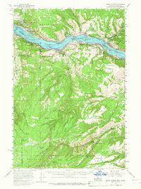
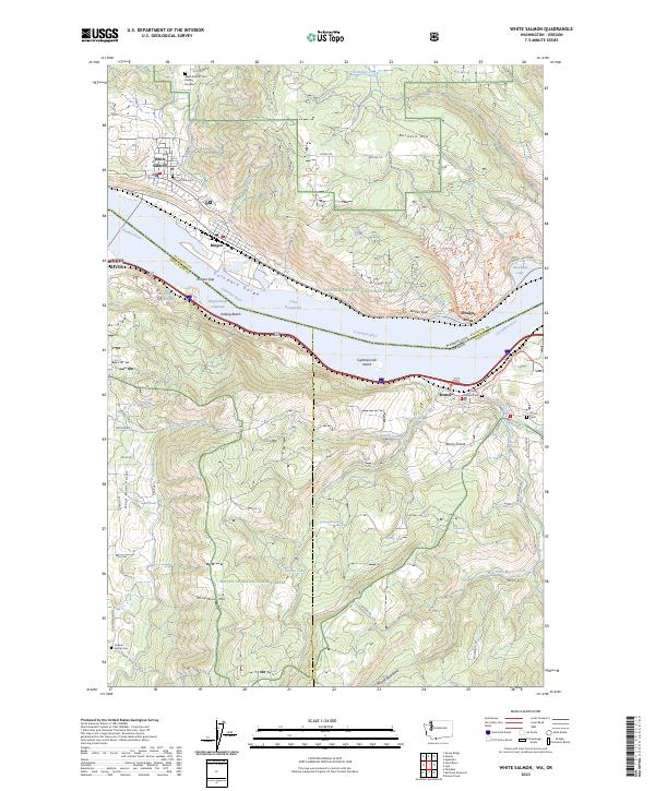
White Salmon and Bingen anchor the Washington shore of the Columbia River in this 2023 landscape, where the Columbia Gorge forms a dramatic natural corridor between the Gifford Pinchot National Forest and Mount Hood National Forest. The map captures the complex topography of the Bingen Gap and the transition into the Hood River Valley to the south. Several family and community landmarks provide significant genealogical value, including the West Klickitat Cem District Number 1, Pioneer Park Cem, and the Jackson Family Cem nestled near Woods Backbone. Transport and elevation define the region, with the Bingen Range Channel cutting through the river near Koberg Beach and trails like the Lyle-Moab Trl winding toward Windy Bluff. This modern record details the intricate water systems of the gorge, from Catherine Creek to the West Fork Mosier Creek, highlighting the enduring connection between these riverfront settlements and their upland surroundings.
Find a feature on this map
80 named features on this map. Tap any name to fly to it.
Don’t see what you’re looking for? This feature index may not catch every label — zoom into the map to look around manually.
Map Details
Editions of this 2023 White Salmon Map
This is the sole edition of this map. No revisions or reprints were ever made.
Historical Maps of Mosier Through Time
5 maps found