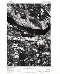
1975 Map of White Salmon
USGS Topo · Published 1980About this map
The Columbia River serves as the central artery and dividing line in this 1975 orthophotograph, separating the riverside communities of Washington and Oregon. This specific survey, produced in cooperation with the Soil Conservation Service, uses aerial photography to capture the intricate patterns of orchards and agricultural fields that define the regional economy. Along the northern bank, the settlements of White Salmon and Bingen are shown in high detail, revealing the layout of streets and industrial zones near the water's edge. Across the river on the Oregon side, Mosier is visible tucked against the shoreline. Unlike a traditional line-drawn map, this photographic record provides an unfiltered look at vegetation density, timber tracks, and the specific footprint of development during the mid-1970s.
Find a feature on this map
4 named features on this map. Tap any name to fly to it.
Don’t see what you’re looking for? This feature index may not catch every label — zoom into the map to look around manually.
Map Details
Editions of this 1975 White Salmon Map
This is the sole edition of this map. No revisions or reprints were ever made.
Other maps of this area

1926 · Hood River
USGS Topo · 1:125,000

1929 · Hood River
USGS Topo · 1:125,000

1934 · The Dalles
USGS Topo · 1:125,000

1953 · The Dalles
USGS Topo · 1:250,000

1956 · The Dalles
USGS Topo · 1:250,000

1957 · The Dalles
USGS Topo · 1:250,000

1957 · Willard
USGS Topo · 1:62,500

1957 · White Salmon
USGS Topo · 1:62,500

1957 · Husum
USGS Topo · 1:62,500

1957 · Hood River
USGS Topo · 1:62,500