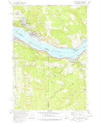
1978 Map of White Salmon
USGS Topo · Published 1978About this map
The Columbia River serves as the central artery and state boundary in this 1970s landscape, where the settlements of White Salmon and Bingen anchor the Washington side against the town of Mosier in Oregon. The topography is dominated by the steep rise of Burdoin Mountain and Tracy Hill to the north, while the southern bank climbs toward Panorama Point and the Hood River Valley. Transportation infrastructure is highly developed along both banks, featuring the Toll Bridge, the Union Pacific tracks, and the Northern Burlington line, illustrating the gorge's role as a vital transit corridor.
Find a feature on this map
55 named features on this map. Tap any name to fly to it.
Don’t see what you’re looking for? This feature index may not catch every label — zoom into the map to look around manually.
Map Details
Editions of this 1978 White Salmon Map
This is the sole edition of this map. No revisions or reprints were ever made.
Other maps of this area

1926 · Hood River
USGS Topo · 1:125,000

1929 · Hood River
USGS Topo · 1:125,000

1934 · The Dalles
USGS Topo · 1:125,000

1953 · The Dalles
USGS Topo · 1:250,000

1956 · The Dalles
USGS Topo · 1:250,000

1957 · The Dalles
USGS Topo · 1:250,000

1957 · Willard
USGS Topo · 1:62,500

1957 · White Salmon
USGS Topo · 1:62,500

1957 · Husum
USGS Topo · 1:62,500

1957 · Hood River
USGS Topo · 1:62,500