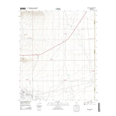
2013 Map of White Sands
USGS Topo · Published 2013About this map
White Sands Missile Range dominates this landscape in the eastern shadow of the San Andres Mountains. The map details the developed White Sands Missile Range Post Area, documenting an intricate street grid that includes Picatinny Ave, Nike Ave, and Aberdeen Ave. This military infrastructure sits at the edge of the vast Tularosa Valley, where the terrain is marked by isolated watering points like Hood Tank and Haystack Tanks. To the northwest, the land rises toward Black Mtn and Rattlesnake Ridge, providing a stark contrast between the desert floor and the high ground. Local hydrologic features, including Bonney Spring and Alamo Spring, indicate the scarce water sources that have long dictated movement through this arid region, while the prominent path of Us-70 E serves as the primary modern transit corridor.
Find a feature on this map
49 named features on this map. Tap any name to fly to it.
Don’t see what you’re looking for? This feature index may not catch every label — zoom into the map to look around manually.
Map Details
Editions of this 2013 White Sands Map
This is the sole edition of this map. No revisions or reprints were ever made.
Other maps of this area

1891 · Las Cruces
USGS Topo · 1:125,000

1893 · Las Cruces
USGS Topo · 1:125,000

1916 · Tonuco
USGS Topo · 1:125,000

1916 · Point Of Sands
USGS Topo · 1:125,000

1932 · Tonuco
USGS Topo · 1:125,000

1941 · Organ Peak
USGS Topo · 1:62,500

1943 · Parker Lake
USGS Topo · 1:62,500

1943 · Organ Peak
USGS Topo · 1:62,500

1947 · Lake Lucero
USGS Topo · 1:62,500

1948 · Davies Tank
USGS Topo · 1:24,000