
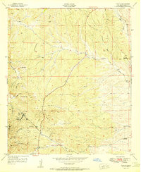
1951 Map of White Signal
USGS Topo · Published 1951About this map
White Signal serves as the focal point of this Grant County survey, situated at the junction of the White Signal Road and Separ Road. The landscape is defined by its mining activity and cattle ranching during the early 1950s, with operations such as the Apache Trail Mine, Gold Lake Mine, and Uncle Sam Mine dotting the terrain between prominent peaks like Tullock Peak and Saddle Mtn. The local community is anchored by the White Signal School and the Community House, while the 7XV Ranch represents the agricultural character of the region. Water sources, vital in this arid environment, are mapped with precision, including the intermittent flows of Cherry Creek, Walnut Creek, and the isolated Stone Corral Spring in the southern reaches. The arrangement of these mines and homesteads relative to the complex drainage systems of Keese Canyon and McDonald Draw offers a clear view of how mid-century industry and life adapted to the high-altitude geography of New Mexico.
Find a feature on this map
20 named features on this map. Tap any name to fly to it.
Don’t see what you’re looking for? This feature index may not catch every label — zoom into the map to look around manually.
Map Details
Editions of this 1951 White Signal Map
This is the sole edition of this map. No revisions or reprints were ever made.
Other maps of this area

1909 · Silver City
USGS Topo · 1:125,000

1949 · Whitewater
USGS Topo · 1:24,000

1949 · Hurley West
USGS Topo · 1:24,000

1950 · Tyrone
USGS Topo · 1:24,000

1950 · White Signal
USGS Topo · 1:24,000

1950 · Wind Mountain
USGS Topo · 1:24,000

1950 · Burro Peak
USGS Topo · 1:24,000

1951 · Big Burro Mountains
USGS Topo · 1:24,000
1951 · Tyrone
USGS Topo · 1:24,000

1951 · Wind Mountain
USGS Topo · 1:24,000