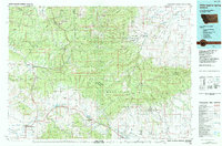
1984 Map of White Sulphur Springs
USGS Topo · Published 1984About this map
The Little Belt Mountains dominate the central landscape of this 1984 study, a region defined by its mining heritage and high-country hydrology. Near the northern edge, the settlement of Neihart serves as a hub for historic extraction, surrounded by named shafts including the Silver Dyke Mine, Cornucopia Mine, and the Queen of the Hills Mine. This area marks the headwaters of several major drainage systems, with the Smith River and Belt Creek flowing north while the Musselshell River originates to the south. In the southwest corner, the namesake White Sulphur Springs sits at a crossroads of ranching and timber country, while the east is characterized by the expansive Judith River State Wildlife Management Area. The map captures a moment when traditional mountain industries like those at Broadwater Mines coexisted with modern conservation boundaries, showing a rugged terrain of peaks like Big Baldy and the distinctive Haymaker Narrows.
Find a feature on this map
54 named features on this map. Tap any name to fly to it.
Don’t see what you’re looking for? This feature index may not catch every label — zoom into the map to look around manually.
Map Details
Editions of this 1984 White Sulphur Springs Map
This is the sole edition of this map. No revisions or reprints were ever made.
Other maps of this area

1886 · Great Falls
USGS Topo · 1:250,000

1886 · Fort Logan
USGS Topo · 1:250,000

1886 · Little Belt Mts.
USGS Topo · 1:250,000

1889 · Big Snowy Mountain
USGS Topo · 1:250,000

1890 · Fort Benton
USGS Topo · 1:250,000

1892 · Fort Benton
USGS Topo · 1:250,000

1893 · Big Snowy Mountain
USGS Topo · 1:250,000

1894 · Little Belt Mts.
USGS Topo · 1:250,000

1897 · Fort Benton
USGS Topo · 1:250,000

1897 · Little Belt Mts.
USGS Topo · 1:250,000
Featured Places
- White Sulphur Springs, MT
- Neihart, MT
- Yogo Crossing, MT
- Mikesell Trailer Court, White Sulphur Springs
- Utica, MT