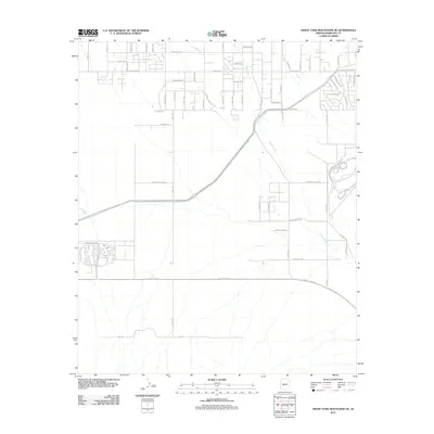
2011 Map of White Tank Mountains NE
USGS Topo · Published 2011About this map
Trilby Wash and Long Wash bisect this arid landscape in the northwest Phoenix valley, where suburban expansion meets the desert floor. The grid of residential streets is clearly taking shape in the early 21st century, with major arteries like Sun Valley Pkwy and Bell Rd providing the framework for future growth. While much of the land remains undeveloped desert, features like Wagner Tank reflect the area's pastoral past, and the naming of W Tip Top Mine Rd hints at the historic prospecting and resource extraction that preceded the modern housing tracts. The detailed layout of roads, from W Jomax Rd to W Beardsley Pkwy, illustrates the transition from open ranchland to a planned residential community in Maricopa County.
Find a feature on this map
51 named features on this map. Tap any name to fly to it.
Don’t see what you’re looking for? This feature index may not catch every label — zoom into the map to look around manually.
Map Details
Editions of this 2011 White Tank Mountains NE Map
This is the sole edition of this map. No revisions or reprints were ever made.
Other maps of this area

1954 · Phoenix
USGS Topo · 1:250,000

1957 · Phoenix
USGS Topo · 1:250,000

1957 · White Tank Mts. SE
USGS Topo · 1:24,000

1957 · White Tank Mts. NE
USGS Topo · 1:24,000

1957 · McMicken Dam
USGS Topo · 1:24,000

1957 · Waddell
USGS Topo · 1:24,000

1957 · White Tank Mts.
USGS Topo · 1:62,500

1958 · Phoenix
USGS Topo · 1:250,000

1960 · Phoenix
USGS Topo · 1:250,000
1965 · Wittmann
USGS Topo · 1:24,000