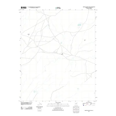
2011 Map of White Water Tank
USGS Topo · Published 2011About this map
Tiis Holoni stands as a central point of human geography in this arid reach of Coconino County, situated at a junction of desert tracks. The landscape is defined by its critical water management features, essential for life and livestock in the high desert, ranging from the namesake White Water Tank in the southwest to the To Kla Daa Aakee Pond in the northeast. Elevation changes are marked by distinct landforms like Pottery Hill and Lii Haaditiih Hill, while scattered catchment points such as Little Black Hill Tank, Horse Water Tanks, and Bidaaii To Haali emphasize the importance of every natural and improved water source. The map reflects a remote area where the placement of roads and tanks follows the logic of the terrain and the necessity of water in the American Southwest.
Find a feature on this map
8 named features on this map. Tap any name to fly to it.
Don’t see what you’re looking for? This feature index may not catch every label — zoom into the map to look around manually.
Map Details
Editions of this 2011 White Water Tank Map
This is the sole edition of this map. No revisions or reprints were ever made.
Other maps of this area

1883 · Tusayan
USGS Topo · 1:250,000

1886 · Tusayan
USGS Topo · 1:250,000

1886 · San Francisco Mtns
USGS Topo · 1:250,000

1891 · San Francisco Mtns
USGS Topo · 1:250,000

1894 · San Francisco Mtns
USGS Topo · 1:250,000

1899 · San Francisco Mtns
USGS Topo · 1:250,000

1947 · Flagstaff
USGS Topo · 1:250,000

1954 · Flagstaff
USGS Topo · 1:250,000

1955 · Grand Falls NE
USGS Topo · 1:24,000

1955 · Black Falls 4 SW
USGS Topo · 1:24,000