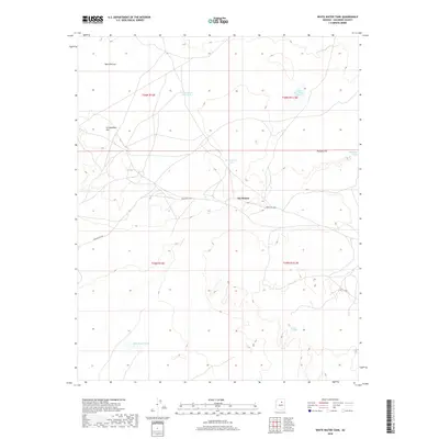
2018 Map of White Water Tank
USGS Topo · Published 2018About this map
Tiis Holoni serves as a focal point in this high-desert landscape within Coconino County, where traditional land management and scarce water resources define the topography. The terrain is marked by significant elevations like Pottery Hill and Lii Haaditiih Hill, which overlook a network of seasonal water catchments including White Water Tank, Horse Water Tanks, and the To Kla Daa Aakee Pond. The winding course of the Dinnebito Wash cuts through the region, while Indian Rte 6730 provides the primary transit corridor across the open reaches of Ward Terrace. This 2018 survey illustrates the persistent importance of named water sources such as Bidaaii To Haali and Little Black Hill Tank in an arid environment where every spring and tank represents a vital landmark for local navigation and livestock.
Find a feature on this map
15 named features on this map. Tap any name to fly to it.
Don’t see what you’re looking for? This feature index may not catch every label — zoom into the map to look around manually.
Map Details
Editions of this 2018 White Water Tank Map
This is the sole edition of this map. No revisions or reprints were ever made.
Other maps of this area

1883 · Tusayan
USGS Topo · 1:250,000

1886 · Tusayan
USGS Topo · 1:250,000

1886 · San Francisco Mtns
USGS Topo · 1:250,000

1891 · San Francisco Mtns
USGS Topo · 1:250,000

1894 · San Francisco Mtns
USGS Topo · 1:250,000

1899 · San Francisco Mtns
USGS Topo · 1:250,000

1947 · Flagstaff
USGS Topo · 1:250,000

1954 · Flagstaff
USGS Topo · 1:250,000

1955 · Grand Falls NE
USGS Topo · 1:24,000

1955 · Black Falls 4 SW
USGS Topo · 1:24,000