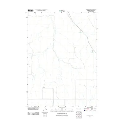
2011 Map of Whiteclay SE
USGS Topo · Published 2011About this map
White Clay Creek meanders through this Sheridan County landscape, carving a drainage pattern that defines the local geography. In this sparsely populated stretch of the Nebraska panhandle, water management is central to the land's utility, evidenced by the presence of Tallon Reservoir and Johnson Reservoir, held by their respective Tallon and Johnson Dams. These features, along with Rush Creek in the southeast corner, indicate the agricultural and ranching priorities of the region during the early 21st century.
Find a feature on this map
9 named features on this map. Tap any name to fly to it.
Don’t see what you’re looking for? This feature index may not catch every label — zoom into the map to look around manually.
Map Details
Editions of this 2011 Whiteclay SE Map
This is the sole edition of this map. No revisions or reprints were ever made.
Other maps of this area

1955 · Alliance
USGS Topo · 1:250,000

1957 · Alliance
USGS Topo · 1:250,000

1958 · Alliance
USGS Topo · 1:250,000

1966 · Rushville
USGS Topo · 1:24,000

1966 · Hay Springs NE
USGS Topo · 1:24,000

1966 · Hay Springs
USGS Topo · 1:24,000

1969 · Whiteclay
USGS Topo · 1:24,000

1969 · Clinton NW
USGS Topo · 1:24,000

1969 · Clinton SW
USGS Topo · 1:24,000

1969 · Beaver Wall
USGS Topo · 1:24,000