
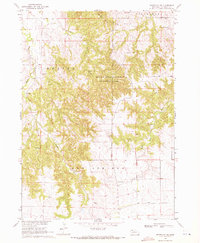
1966 Map of Hay Springs
USGS Topo · Published 1967About this map
Hay Springs serves as the focal point of this mid-1960s survey, situated along the diagonal path of the Chicago and North Western railroad. The town's layout reflects a classic High Plains settlement pattern, with the Hay Springs Municipal Airport and a municipal Sewage Disposal facility bordering the residential core. Outside the village limits, the landscape is defined by the winding course of Hay Springs Creek and the localized drainage toward Walgren Lake, which is preserved within the Walgren State Recreation Area.
Find a feature on this map
13 named features on this map. Tap any name to fly to it.
Don’t see what you’re looking for? This feature index may not catch every label — zoom into the map to look around manually.
Map Details
Editions of this 1966 Hay Springs Map
This is the sole edition of this map. No revisions or reprints were ever made.
Other maps of this area

1955 · Alliance
USGS Topo · 1:250,000

1957 · Alliance
USGS Topo · 1:250,000

1958 · Alliance
USGS Topo · 1:250,000

1960 · Hay Springs SW
USGS Topo · 1:24,000

1960 · Hay Springs SE
USGS Topo · 1:24,000

1966 · Chadron 3 SE
USGS Topo · 1:24,000

1966 · Hay Springs NE
USGS Topo · 1:24,000

1966 · Chadron 3 NE
USGS Topo · 1:24,000

1969 · Bordeaux
USGS Topo · 1:24,000
1969 · Whiteclay SW
USGS Topo · 1:24,000