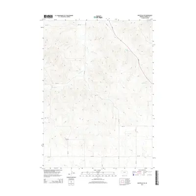
2014 Map of Whiteclay SE
USGS Topo · Published 2014About this map
Novotny Cem sits as a quiet landmark within the high plains of Sheridan County, illustrating the sparse settlement patterns of this corner of Nebraska. The landscape is defined by the winding paths of White Clay Cr and Rush Cr, which snake through the varied topography. For decades, water management has been central to the local economy, evidenced by features such as the Tallon Reservoir and Johnson Reservoir. A network of rural section roads and trails, including 700TH Trl and 430TH Trl, connect the isolated homesteads and ranch lands that dominate the area. The primary transit artery, Ne 87, cuts diagonally across the northeastern portion of the quadrangle, linking this agricultural interior to wider regional markets.
Find a feature on this map
16 named features on this map. Tap any name to fly to it.
Don’t see what you’re looking for? This feature index may not catch every label — zoom into the map to look around manually.
Map Details
Editions of this 2014 Whiteclay SE Map
This is the sole edition of this map. No revisions or reprints were ever made.
Other maps of this area

1955 · Alliance
USGS Topo · 1:250,000

1957 · Alliance
USGS Topo · 1:250,000

1958 · Alliance
USGS Topo · 1:250,000

1966 · Rushville
USGS Topo · 1:24,000

1966 · Hay Springs NE
USGS Topo · 1:24,000

1966 · Hay Springs
USGS Topo · 1:24,000

1969 · Whiteclay
USGS Topo · 1:24,000

1969 · Clinton NW
USGS Topo · 1:24,000

1969 · Clinton SW
USGS Topo · 1:24,000

1969 · Beaver Wall
USGS Topo · 1:24,000