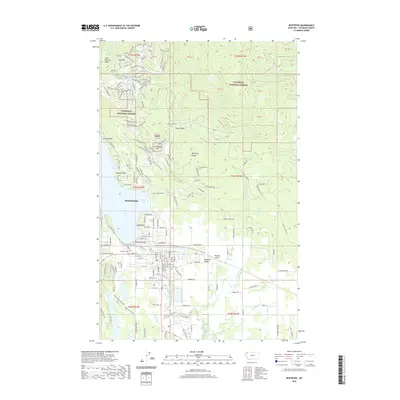
2020 Map of Whitefish
USGS Topo · Published 2020About this map
The resort and rail town of Whitefish serves as the focal point for this 2020 survey, showing the intricate street grid and lakeshore developments along Whitefish Lake. The map captures the transition from the residential blocks and the Whitefish Airport in the Flathead Valley to the steep rises of the Whitefish Range to the north. Notable local landmarks like the Whitefish Cemetery and the shoreline communities of Bay Point and Orchard Point reflect the long-standing settlement patterns of the area.
Find a feature on this map
167 named features on this map. Tap any name to fly to it.
Don’t see what you’re looking for? This feature index may not catch every label — zoom into the map to look around manually.
Map Details
Editions of this 2020 Whitefish Map
This is the sole edition of this map. No revisions or reprints were ever made.
Other maps of this area

1906 · Kintla Lakes
USGS Topo · 1:125,000

1938 · Kintla Lakes
USGS Topo · 1:125,000

1943 · Kalispell
USGS Topo · 1:125,000

1957 · Kalispell
USGS Topo · 1:250,000

1960 · Kalispell
USGS Topo · 1:250,000

1961 · Kalispell
USGS Topo · 1:250,000

1962 · Columbia Falls South
USGS Topo · 1:24,000

1962 · Rose Crossing
USGS Topo · 1:24,000

1962 · Beaver Lake
USGS Topo · 1:24,000

1962 · Rhodes
USGS Topo · 1:24,000