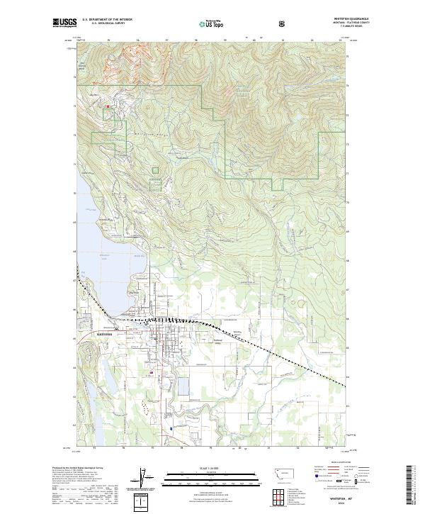
2024 Map of Whitefish
USGS Topo · Published 2024About this map
Whitefish serves as the gateway to the Whitefish Range, situated at the southern tip of Whitefish Lake. This contemporary map reveals the modern infrastructure of the Flathead Valley, showing the dense grid of the city center alongside newer residential expansions at Houston Point and Orchard Point. To the north, the terrain rises sharply toward Big Mtn and the Hell Roaring Basin, areas dominated by the Flathead National Forest. The map documents a landscape defined by its glacial geography, where drainage from Haskill Creek and Walker Creek feeds into the Whitefish River. Significant landmarks include the Whitefish Airport and the Whitefish Cem, providing local reference points for researchers tracking the community's footprint between the lakefront and the mountain slopes.
Find a feature on this map
145 named features on this map. Tap any name to fly to it.
Don’t see what you’re looking for? This feature index may not catch every label — zoom into the map to look around manually.
Map Details
Editions of this 2024 Whitefish Map
This is the sole edition of this map. No revisions or reprints were ever made.
Other maps of this area

1906 · Kintla Lakes
USGS Topo · 1:125,000

1938 · Kintla Lakes
USGS Topo · 1:125,000

1943 · Kalispell
USGS Topo · 1:125,000

1957 · Kalispell
USGS Topo · 1:250,000

1960 · Kalispell
USGS Topo · 1:250,000

1961 · Kalispell
USGS Topo · 1:250,000

1962 · Columbia Falls South
USGS Topo · 1:24,000

1962 · Rose Crossing
USGS Topo · 1:24,000

1962 · Beaver Lake
USGS Topo · 1:24,000

1962 · Rhodes
USGS Topo · 1:24,000