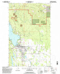
1994 Map of Whitefish
USGS Topo · Published 1997About this map
Whitefish serves as a gateway to the Whitefish Range and the Flathead National Forest during the mid-1990s. The town sits at the intersection of a significant rail corridor and a mountain resort economy, with the Burlington Northern tracks running parallel to the Whitefish River. On the northern horizon, Big Mountain dominates the landscape, featuring a developed ski resort and the Knights of Columbus Shrine. The survey details the town's growth patterns, including the High Sch and Central Sch, alongside lakeside landmarks like City Beach and Whitefish Lake State Park. Water management and industrial sites are documented, from the Sewage Disposal plant near the river to various Gravel Pits and the Micho Mine. This era shows the developed shoreline around Monks Bay and Carver Bay, while Blanchard Lake and Sampson Lake remain relatively secluded to the southwest.
Find a feature on this map
54 named features on this map. Tap any name to fly to it.
Don’t see what you’re looking for? This feature index may not catch every label — zoom into the map to look around manually.
Map Details
Editions of this 1994 Whitefish Map
This is the sole edition of this map. No revisions or reprints were ever made.
Other maps of this area

1906 · Kintla Lakes
USGS Topo · 1:125,000

1938 · Kintla Lakes
USGS Topo · 1:125,000

1943 · Kalispell
USGS Topo · 1:125,000

1957 · Kalispell
USGS Topo · 1:250,000

1960 · Kalispell
USGS Topo · 1:250,000

1961 · Kalispell
USGS Topo · 1:250,000

1962 · Columbia Falls South
USGS Topo · 1:24,000

1962 · Rose Crossing
USGS Topo · 1:24,000

1962 · Beaver Lake
USGS Topo · 1:24,000

1962 · Rhodes
USGS Topo · 1:24,000