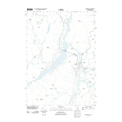
2011 Map of Whitehall
USGS Topo · Published 2011About this map
Whitehall serves as the focal point of this 2011 survey, situated at the strategic junction where the The Champlain Canal meets the Mettawee River and the head of Lake Champlain. The landscape is defined by the narrow water passage of South Bay and the surrounding high ground of the Adirondack Park, including Skene Mountain and West Mountain. The town's burial grounds, such as Boardman Cemetery and Williams Street Cemetery, are meticulously documented alongside river infrastructure like the Lock Twelve Marina.
Find a feature on this map
66 named features on this map. Tap any name to fly to it.
Don’t see what you’re looking for? This feature index may not catch every label — zoom into the map to look around manually.
Map Details
Editions of this 2011 Whitehall Map
This is the sole edition of this map. No revisions or reprints were ever made.
Other maps of this area

1893 · Fort Ann
USGS Topo · 1:62,500

1893 · Whitehall
USGS Topo · 1:62,500

1895 · Whitehall
USGS Topo · 1:62,500

1895 · Fort Ann
USGS Topo · 1:62,500

1895 · Glens Falls
USGS Topo · 1:62,500

1897 · Bolton
USGS Topo · 1:62,500

1897 · Glens Falls
USGS Topo · 1:62,500

1898 · Whitehall
USGS Topo · 1:62,500

1898 · Fort Ann
USGS Topo · 1:62,500

1900 · Bolton
USGS Topo · 1:62,500