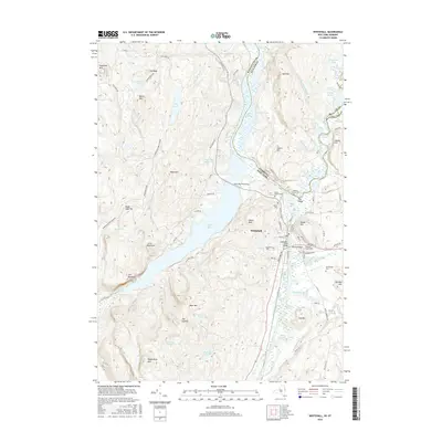
2016 Map of Whitehall
USGS Topo · Published 2016About this map
Whitehall sits at the southern terminus of Lake Champlain, where the historic Champlain Canal meets the Mettawee River and Wood Creek. This 2016 survey illustrates the complex intersection of waterborne transport and rail infrastructure, centered on the Champlain Canal Bridge. The landscape is dominated by significant elevations such as Skene Mtn and West Mtn, which frame the narrow valley where the village developed. To the west, the Adirondack Park Preserve protects the high ground of Black Lead Hill and the unique landform known as the Diameter. Genealogists will find a high density of burial grounds in the vicinity, including Boardman Cem, Neddo Cem, and the dual cemeteries near The Elbow — Rodd-Elbow Cem and Adams-Elbow Cem. The geography is further defined by extensive wetlands like Duso Marsh and the Drowned Lands along the state border.
Find a feature on this map
97 named features on this map. Tap any name to fly to it.
Don’t see what you’re looking for? This feature index may not catch every label — zoom into the map to look around manually.
Map Details
Editions of this 2016 Whitehall Map
This is the sole edition of this map. No revisions or reprints were ever made.
Other maps of this area

1893 · Fort Ann
USGS Topo · 1:62,500

1893 · Whitehall
USGS Topo · 1:62,500

1895 · Whitehall
USGS Topo · 1:62,500

1895 · Fort Ann
USGS Topo · 1:62,500

1895 · Glens Falls
USGS Topo · 1:62,500

1897 · Bolton
USGS Topo · 1:62,500

1897 · Glens Falls
USGS Topo · 1:62,500

1898 · Whitehall
USGS Topo · 1:62,500

1898 · Fort Ann
USGS Topo · 1:62,500

1900 · Bolton
USGS Topo · 1:62,500