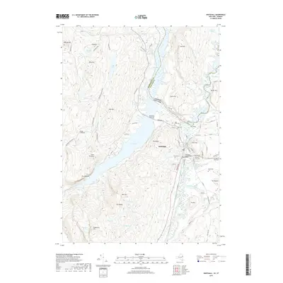
2019 Map of Whitehall
USGS Topo · Published 2019About this map
Whitehall serves as a critical junction for water and rail traffic near the Vermont and New York state line. The village is defined by its maritime heritage, featuring the Champlain Canal Bridge and the winding Wood Creek, which navigate the gap between Skene Mtn and Death Rock. This 2019 survey documents the complex geography of the South Bay and its connection to the Drowned Lands of the northern marshes. To the east, the Mettawee River meanders toward The Elbow, while the surrounding uplands include several historical burial grounds such as Greenmount Cem and Our Lady of Angels Cem. The landscape transitions from the managed waterways of the canal to the protected wilderness of the Adirondack Park and its preserve. Notable local landmarks like Devils Pulpit and the industrial history suggested by Ore Bed Hill provide a window into the region's geological and economic past.
Find a feature on this map
90 named features on this map. Tap any name to fly to it.
Don’t see what you’re looking for? This feature index may not catch every label — zoom into the map to look around manually.
Map Details
Editions of this 2019 Whitehall Map
This is the sole edition of this map. No revisions or reprints were ever made.
Other maps of this area

1893 · Fort Ann
USGS Topo · 1:62,500

1893 · Whitehall
USGS Topo · 1:62,500

1895 · Whitehall
USGS Topo · 1:62,500

1895 · Fort Ann
USGS Topo · 1:62,500

1895 · Glens Falls
USGS Topo · 1:62,500

1897 · Bolton
USGS Topo · 1:62,500

1897 · Glens Falls
USGS Topo · 1:62,500

1898 · Whitehall
USGS Topo · 1:62,500

1898 · Fort Ann
USGS Topo · 1:62,500

1900 · Bolton
USGS Topo · 1:62,500