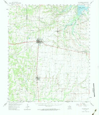
1958 Map of Whitesboro
USGS Topo · Published 1984About this map
Whitesboro serves as a central hub in this late 1950s survey of Grayson County, where the intersection of the Texas and Pacific and Missouri Kansas Texas railroads defines the local commerce. The landscape is a dense network of family heritage and oil exploration, marked by dozens of small burial grounds like Akers Cem and Herod-Morris Cem, alongside active drilling zones such as the Walnut Bend Oil Field and Dawkins Oil Field.
Find a feature on this map
65 named features on this map. Tap any name to fly to it.
Don’t see what you’re looking for? This feature index may not catch every label — zoom into the map to look around manually.
Map Details
Editions of this 1958 Whitesboro Map
3 editions found
Other maps of this area

1901 · Denison
USGS Topo · 1:125,000

1902 · Gainesville
USGS Topo · 1:125,000

1943 · Gainesville
USGS Topo · 1:125,000

1954 · Sherman
USGS Topo · 1:250,000

1958 · Dorchester
USGS Topo · 1:24,000

1958 · Gordonville
USGS Topo · 1:62,500

1958 · Denison Dam
USGS Topo · 1:62,500

1958 · Sherman NW
USGS Topo · 1:24,000

1958 · Whitesboro
USGS Topo · 1:62,500

1958 · Sherman
USGS Topo · 1:250,000