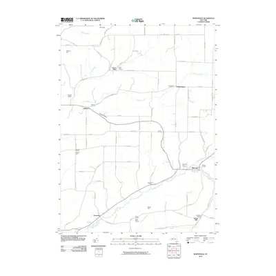
2010 Map of Whitesville
USGS Topo · Published 2010About this map
Whitesville and Independence serve as primary hubs in this corner of Allegany County, where the rural landscape is defined by the winding paths of Chenunda Creek and Cryder Creek. The settlement pattern follows these narrow valley floors, connected by a network of named roads like Fulmer Valley Rd and Hallsport-Independence Rd that bridge the gaps between upland terrain features such as Beech Hill and Voorhees Hill.
Find a feature on this map
80 named features on this map. Tap any name to fly to it.
Don’t see what you’re looking for? This feature index may not catch every label — zoom into the map to look around manually.
Map Details
Editions of this 2010 Whitesville Map
This is the sole edition of this map. No revisions or reprints were ever made.
Other maps of this area

1899 · Gaines
USGS Topo · 1:62,500

1900 · Gaines
USGS Topo · 1:62,500

1926 · Wellsville
USGS Topo · 1:62,500

1926 · Greenwood
USGS Topo · 1:62,500

1932 · Genesee
USGS Topo · 1:62,500

1937 · Genesee
USGS Topo · 1:62,500

1950 · Elmira
USGS Topo · 1:250,000

1954 · Williamsport
USGS Topo · 1:250,000
1957 · Harrison Valley
USGS Topo · 1:24,000

1958 · Elmira
USGS Topo · 1:250,000