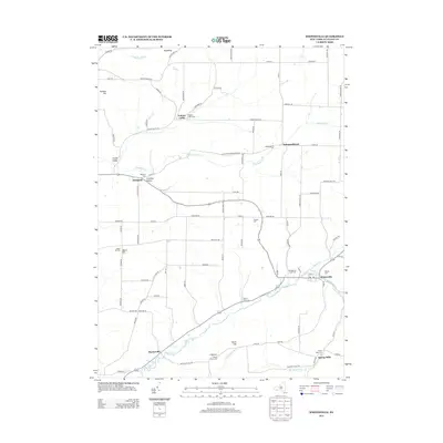
2013 Map of Whitesville
USGS Topo · Published 2013About this map
Whitesville and its surrounding rural hamlets are defined by a network of winding valley roads and numerous family and community burial grounds. This Allegany County landscape is carved by substantial waterways, including the southward-flowing Cryder Cr and the meandering Chenunda Cr, which dictate the placement of small settlements like Hallsport and Spring Mills. The distribution of cemeteries across the township—from the Whitesville Rural Cemetery to the isolated Pioneer Cemetery—points to a long-established agricultural population. Notable terrain features such as South Hill and Roundtop rise between the creek beds, while the presence of the Po in Whitesville indicates its role as the primary service center for the scattered residents of Fulmer Valley and Paynesville.
Find a feature on this map
97 named features on this map. Tap any name to fly to it.
Don’t see what you’re looking for? This feature index may not catch every label — zoom into the map to look around manually.
Map Details
Editions of this 2013 Whitesville Map
This is the sole edition of this map. No revisions or reprints were ever made.
Other maps of this area

1899 · Gaines
USGS Topo · 1:62,500

1900 · Gaines
USGS Topo · 1:62,500

1926 · Wellsville
USGS Topo · 1:62,500

1926 · Greenwood
USGS Topo · 1:62,500

1932 · Genesee
USGS Topo · 1:62,500

1937 · Genesee
USGS Topo · 1:62,500

1950 · Elmira
USGS Topo · 1:250,000

1954 · Williamsport
USGS Topo · 1:250,000
1957 · Harrison Valley
USGS Topo · 1:24,000

1958 · Elmira
USGS Topo · 1:250,000