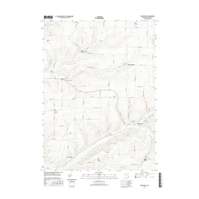
2016 Map of Whitesville
USGS Topo · Published 2016About this map
Whitesville anchors this part of Allegany County, situated at the confluence of Cryder Creek and Marsh Cr, where the valley floors provide a level footing for the town's grid. The surrounding terrain is defined by high ridges and deep valleys, including Christian Hollow and Best Hollow, which have historically dictated the placement of roads and small settlements like Hallsport and Paynesville. A notable concentration of community burial grounds, such as the United States Cem and Whitesville Rural Cem, suggests a long-established pattern of rural residency and family heritage tied to specific hillside reaches.
Find a feature on this map
92 named features on this map. Tap any name to fly to it.
Don’t see what you’re looking for? This feature index may not catch every label — zoom into the map to look around manually.
Map Details
Editions of this 2016 Whitesville Map
This is the sole edition of this map. No revisions or reprints were ever made.
Other maps of this area

1899 · Gaines
USGS Topo · 1:62,500

1900 · Gaines
USGS Topo · 1:62,500

1926 · Wellsville
USGS Topo · 1:62,500

1926 · Greenwood
USGS Topo · 1:62,500

1932 · Genesee
USGS Topo · 1:62,500

1937 · Genesee
USGS Topo · 1:62,500

1950 · Elmira
USGS Topo · 1:250,000

1954 · Williamsport
USGS Topo · 1:250,000
1957 · Harrison Valley
USGS Topo · 1:24,000

1958 · Elmira
USGS Topo · 1:250,000