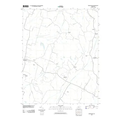
2010 Map of Whitesville
USGS Topo · Published 2010About this map
Whitesville serves as the primary hub in this portion of Daviess County, where rural life is defined by the winding paths of the North Fork Panther Creek and South Fork Panther Creek. This 2010 survey illustrates a landscape deeply rooted in family and community history, evidenced by a high density of burial grounds including Saint Mary of the Woods Cemetery and Barnetts Knob Cemetery. The settlement pattern follows established corridors like Old Leitchfield Rd and Morgantown Rd, connecting smaller named locales such as Aetnaville, Deanefield, and the curiously named Oklahoma. Genealogists will find particular value in the numerous small family or community plots, such as Bellamy Cemetery, Ellis Cemetery, and Haynes Cemetery, which are scattered throughout the agricultural tracts and riparian corridors. The map records a modern road network that still honors older property boundaries and local landmarks, from Herbert to Roseville.
Find a feature on this map
56 named features on this map. Tap any name to fly to it.
Don’t see what you’re looking for? This feature index may not catch every label — zoom into the map to look around manually.
Map Details
Editions of this 2010 Whitesville Map
This is the sole edition of this map. No revisions or reprints were ever made.
Other maps of this area

1903 · Tell City
USGS Topo · 1:62,500

1907 · Whitesville
USGS Topo · 1:62,500

1909 · Whitesville
USGS Topo · 1:62,500

1932 · Fordsville
USGS Topo · 1:62,500

1934 · Cannelton
USGS Topo · 1:62,500

1953 · Philpot
USGS Topo · 1:24,000

1953 · Dundee
USGS Topo · 1:24,000

1953 · Cloverport
USGS Topo · 1:24,000

1953 · Whitesville
USGS Topo · 1:24,000

1953 · Pleasant Ridge
USGS Topo · 1:24,000