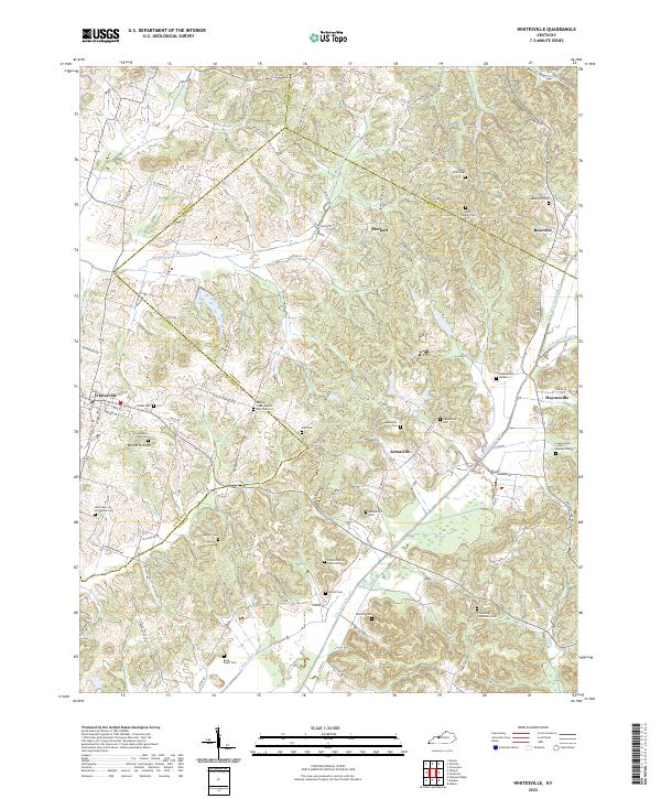
2022 Map of Whitesville
USGS Topo · Published 2022About this map
Whitesville anchors the western edge of this landscape where the boundaries of Daviess, Ohio, and Hancock counties converge. The terrain is defined by the winding tributaries of the Panther Creek system, including the N Fork Panther Cr and S Fork Panther Cr. This area is densely populated with family and community burial grounds, such as the Saint Mary of the Woods Cem and the Panther Creek Baptist Church Cem, which serve as critical markers of early settlement patterns in this part of Kentucky.
Find a feature on this map
82 named features on this map. Tap any name to fly to it.
Don’t see what you’re looking for? This feature index may not catch every label — zoom into the map to look around manually.
Map Details
Editions of this 2022 Whitesville Map
This is the sole edition of this map. No revisions or reprints were ever made.
Other maps of this area

1903 · Tell City
USGS Topo · 1:62,500

1907 · Whitesville
USGS Topo · 1:62,500

1909 · Whitesville
USGS Topo · 1:62,500

1932 · Fordsville
USGS Topo · 1:62,500

1934 · Cannelton
USGS Topo · 1:62,500

1953 · Philpot
USGS Topo · 1:24,000

1953 · Dundee
USGS Topo · 1:24,000

1953 · Cloverport
USGS Topo · 1:24,000

1953 · Whitesville
USGS Topo · 1:24,000

1953 · Pleasant Ridge
USGS Topo · 1:24,000