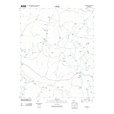
2010 Map of Whitfield
USGS Topo · Published 2010About this map
The Duck River and Piney River dominate this landscape, creating a winding network of bends and shoals where agriculture and settlement have long followed the water. River crossings such as Scotts Ford, Hicks Ford, and Huddlestons Ford indicate a history of local commerce and connectivity before modern bridges like Beaverdam Bridge became the primary arteries. The map reveals a high density of family-named burial grounds, including the Weatherspoon Cemetery, Fowlkes Cemetery, and Huddleston Cemetery, which serve as vital markers of the area's genealogical heritage.
Find a feature on this map
125 named features on this map. Tap any name to fly to it.
Don’t see what you’re looking for? This feature index may not catch every label — zoom into the map to look around manually.
Map Details
Editions of this 2010 Whitfield Map
This is the sole edition of this map. No revisions or reprints were ever made.
Other maps of this area

1901 · Colombia
USGS Topo · 1:125,000

1936 · Pleasantville
USGS Topo · 1:24,000

1936 · Coble
USGS Topo · 1:24,000

1936 · Beaverdam Springs
USGS Topo · 1:24,000

1936 · Nunnelly
USGS Topo · 1:24,000

1936 · Whitfield
USGS Topo · 1:24,000

1936 · Sunrise
USGS Topo · 1:24,000

1936 · Bucksnort
USGS Topo · 1:24,000

1936 · Texas Hollow
USGS Topo · 1:24,000

1936 · Spot
USGS Topo · 1:24,000