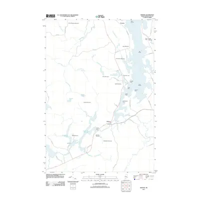
2011 Map of Whiting
USGS Topo · Published 2011About this map
Whiting and the neighboring settlements of Edmunds and North Trescott sit at the intersection of Downeast waterways and granite hills. The landscape is defined by an intricate network of water management, evidenced by Crane Dam, Orange River Dam, and Mill Dam, which regulate the flow from the Orange River Reservoir and Crane Mill Brook Reservoir toward Whiting Bay. These reservoirs and dams indicate a long history of water-powered industry and tidal influence in Washington County.
Find a feature on this map
65 named features on this map. Tap any name to fly to it.
Don’t see what you’re looking for? This feature index may not catch every label — zoom into the map to look around manually.
Map Details
Editions of this 2011 Whiting Map
This is the sole edition of this map. No revisions or reprints were ever made.
Other maps of this area

1907 · Eastport
USGS Topo · 1:48,000

1908 · Eastport
USGS Topo · 1:62,500

1917 · Cutler
USGS Topo · 1:62,500

1918 · Machias
USGS Topo · 1:62,500

1918 · Cutler
USGS Topo · 1:62,500

1941 · Machias
USGS Topo · 1:62,500

1941 · Gardner Lake
USGS Topo · 1:62,500

1943 · Gardner Lake
USGS Topo · 1:62,500

1943 · Eastport
USGS Topo · 1:62,500

1945 · Eastport
USGS Topo · 1:62,500