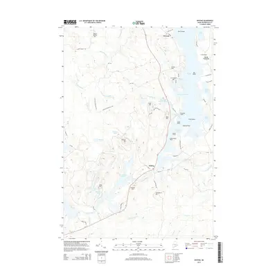
2014 Map of Whiting
USGS Topo · Published 2014About this map
Whiting serves as a central junction where Us-1 meets Lubec Rd, overlooking the significant Orange River Reservoir. This coastal landscape in Washington County is defined by its numerous tidal coves and rugged granite rises, including Pughole Mtn and Keniston Mtn. To the north, the settlement of Edmunds is situated near the Whiting Bay shoreline, a region marked by extensive waterways like Sunken Stream and Hobart Stream. The map reveals a balance of inland freshwater systems and maritime features, with the Edmunds Wilderness Trail cutting through the dense interior terrain west of Crane Mill Brook. Along the eastern edge, the indented coastline provides protected waters at Carrying Place Cove and Weir Cove, which are separated by prominent landmarks such as Crow Neck. This 2014 survey documents the enduring road networks and hydrologic features that have shaped the economy and community layout of this Down East region.
Find a feature on this map
78 named features on this map. Tap any name to fly to it.
Don’t see what you’re looking for? This feature index may not catch every label — zoom into the map to look around manually.
Map Details
Editions of this 2014 Whiting Map
This is the sole edition of this map. No revisions or reprints were ever made.
Other maps of this area

1907 · Eastport
USGS Topo · 1:48,000

1908 · Eastport
USGS Topo · 1:62,500

1917 · Cutler
USGS Topo · 1:62,500

1918 · Machias
USGS Topo · 1:62,500

1918 · Cutler
USGS Topo · 1:62,500

1941 · Machias
USGS Topo · 1:62,500

1941 · Gardner Lake
USGS Topo · 1:62,500

1943 · Gardner Lake
USGS Topo · 1:62,500

1943 · Eastport
USGS Topo · 1:62,500

1945 · Eastport
USGS Topo · 1:62,500