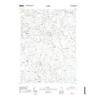
2021 Map of Whitman
USGS Topo · Published 2021About this map
Abington and Whitman anchor this modern-era study of Plymouth County, where the transition from industrial rail corridors to recreational greenways is evident along the Hanover Branch Rail-Trl. The map is particularly notable for its dense concentration of genealogical landmarks, including the Torrey Family Burying Ground, the Bicknell Family Tomb, and the Nash Family Tomb Cem, offering a detailed view of the region's ancestral landscape. To the west, the urban reach of Brockton is marked by major institutions like the Signature Healthcare Brockton Hospital School of Nursing. The natural geography is defined by a complex network of waterways, including the Shumatuscacant River and the Satucket River, which flow through low-lying areas such as Bear Meadow and Beech Hill Swamp. This data provides a clear record of established settlements like East Bridgewater and Elmwood alongside contemporary conservation corridors like the Bay Circuit Trl.
Find a feature on this map
70 named features on this map. Tap any name to fly to it.
Don’t see what you’re looking for? This feature index may not catch every label — zoom into the map to look around manually.
Map Details
Editions of this 2021 Whitman Map
This is the sole edition of this map. No revisions or reprints were ever made.
Other maps of this area

1885 · Abington
USGS Topo · 1:62,500

1885 · Middleboro
USGS Topo · 1:62,500

1885 · Taunton
USGS Topo · 1:62,500

1886 · Dedham
USGS Topo · 1:62,500

1888 · Taunton
USGS Topo · 1:62,500

1888 · Middleboro
USGS Topo · 1:62,500

1888 · Abington
USGS Topo · 1:62,500

1893 · Abington
USGS Topo · 1:62,500

1893 · Taunton
USGS Topo · 1:62,500

1893 · Middleboro
USGS Topo · 1:62,500