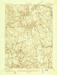
1936 Map of Whitman
USGS Topo · Published 1936About this map
Whitman and Abington serve as the primary population centers on this 1930s sheet, displaying a mature landscape of residential streets, cemeteries, and schools. Industrial activity is most prominent at the National Fire Works Inc facility near West Hanover, while the New York New Haven and Hartford Railroad provides a critical backbone for transport through Rockland and East Bridgewater. The terrain is characterized by numerous small bodies of water and wetlands, such as Beech Hill Swamp and Bear Meadow, which influence the winding paths of local thoroughfares like Washington Street.
Find a feature on this map
64 named features on this map. Tap any name to fly to it.
Don’t see what you’re looking for? This feature index may not catch every label — zoom into the map to look around manually.
Map Details
Editions of this 1936 Whitman Map
This is the sole edition of this map. No revisions or reprints were ever made.
Other maps of this area

1885 · Abington
USGS Topo · 1:62,500

1885 · Middleboro
USGS Topo · 1:62,500

1885 · Taunton
USGS Topo · 1:62,500

1886 · Dedham
USGS Topo · 1:62,500

1888 · Taunton
USGS Topo · 1:62,500

1888 · Middleboro
USGS Topo · 1:62,500

1888 · Abington
USGS Topo · 1:62,500

1893 · Abington
USGS Topo · 1:62,500

1893 · Taunton
USGS Topo · 1:62,500

1893 · Middleboro
USGS Topo · 1:62,500