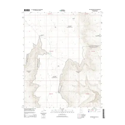
2014 Map of Whitmore Point SW
USGS Topo · Published 2014About this map
Grand Canyon National Park and the Lake Mead National Recreation Area converge in this high-desert landscape within Mohave County. The topography is defined by significant drainage systems and seasonal water sources essential for survival in this arid environment. Key water features include Green Spring, located at the head of Green Spring Canyon, and the curiously named Ambush Water Pocket near Pen Pocket. These natural catchments and springs, alongside Spencer Tank, represent the vital infrastructure of the ranching and wilderness history in the Arizona Strip. The inclusion of Pine Valley and Salaratus Draw further illustrates a terrain carved by intermittent water flow, while the presence of Az-67 provides the primary artery through this protected federal land.
Find a feature on this map
17 named features on this map. Tap any name to fly to it.
Don’t see what you’re looking for? This feature index may not catch every label — zoom into the map to look around manually.
Map Details
Editions of this 2014 Whitmore Point SW Map
This is the sole edition of this map. No revisions or reprints were ever made.
Other maps of this area

1886 · Diamond Creek
USGS Topo · 1:250,000

1886 · Mt. Trumbull
USGS Topo · 1:250,000

1892 · Diamond Creek
USGS Topo · 1:250,000

1892 · Mt. Trumbull
USGS Topo · 1:250,000

1948 · Williams
USGS Topo · 1:250,000

1953 · Grand Canyon
USGS Topo · 1:250,000

1954 · Williams
USGS Topo · 1:250,000

1956 · Williams
USGS Topo · 1:250,000

1957 · Grand Canyon
USGS Topo · 1:250,000

1958 · Grand Canyon
USGS Topo · 1:250,000