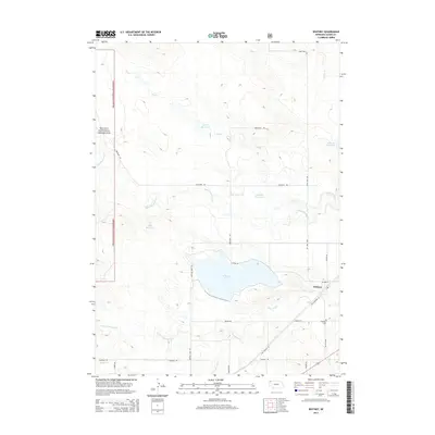
2014 Map of Whitney
USGS Topo · Published 2014About this map
Whitney occupies the high ground south of the White River in this Northwestern Nebraska landscape, where the prairie transitions into the managed acreage of the Oglala National Grassland. The settlement pattern here is dictated by water management, with the large expanse of Whitney Lake and various smaller impoundments like Stewart Reservoir and Pilster Reservoir providing essential resources for the surrounding ranching and agricultural lands. The map details the local road network connecting these remote outposts, following drainage lines like Big Cottonwood Cr and Dry Cr. Genealogists and local historians can locate the Whitney Cem situated just south of the village, and trace the path of Old Highway 20 as it cuts across the southern portion of the quadrangle. The terrain is marked by distinctive named landmarks such as Lone Tree, which served as navigation points in the open country of Dawes County.
Find a feature on this map
30 named features on this map. Tap any name to fly to it.
Don’t see what you’re looking for? This feature index may not catch every label — zoom into the map to look around manually.
Map Details
Editions of this 2014 Whitney Map
This is the sole edition of this map. No revisions or reprints were ever made.
Other maps of this area

1955 · Alliance
USGS Topo · 1:250,000

1957 · Alliance
USGS Topo · 1:250,000

1958 · Alliance
USGS Topo · 1:250,000

1980 · Horn
USGS Topo · 1:24,000

1980 · Crow Butte
USGS Topo · 1:24,000

1980 · Wolf Butte
USGS Topo · 1:24,000

1980 · Lone Tree Ranch
USGS Topo · 1:24,000

1980 · Wayside
USGS Topo · 1:24,000
1980 · Trunk Butte
USGS Topo · 1:24,000
1980 · Chimney Butte
USGS Topo · 1:24,000