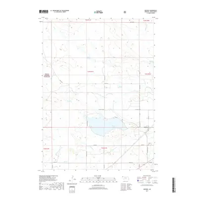
2017 Map of Whitney
USGS Topo · Published 2017About this map
The White River and its tributary network define the prairie landscape of Dawes County in this 2017 survey. The small settlement of Whitney sits near the river's path, serving as a focal point for the surrounding ranching and agricultural operations. This area is characterized by an extensive system of water management, evidenced by numerous man-made features like Whitney Lake, Stewart Reservoir, Blust Reservoir, and Pilster Reservoir, which capture runoff from intermittent streams such as Big Cottonwood Cr and Dry Cr.
Find a feature on this map
40 named features on this map. Tap any name to fly to it.
Don’t see what you’re looking for? This feature index may not catch every label — zoom into the map to look around manually.
Map Details
Editions of this 2017 Whitney Map
This is the sole edition of this map. No revisions or reprints were ever made.
Other maps of this area

1955 · Alliance
USGS Topo · 1:250,000

1957 · Alliance
USGS Topo · 1:250,000

1958 · Alliance
USGS Topo · 1:250,000

1980 · Horn
USGS Topo · 1:24,000

1980 · Crow Butte
USGS Topo · 1:24,000

1980 · Wolf Butte
USGS Topo · 1:24,000

1980 · Lone Tree Ranch
USGS Topo · 1:24,000

1980 · Wayside
USGS Topo · 1:24,000
1980 · Trunk Butte
USGS Topo · 1:24,000
1980 · Chimney Butte
USGS Topo · 1:24,000