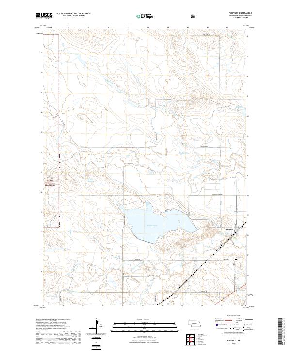
2021 Map of Whitney
USGS Topo · Published 2021About this map
The village of Whitney anchors this section of Dawes County, situated along the White River in a landscape defined by significant water management and open rangeland. To the west, the Oglala National Grassland begins, while the central portion is dominated by the large Whitney Lake. This reservoir, along with smaller catchments like Blust Reservoir, Stewart Reservoir, and Baldwin Reservoir, illustrates the critical importance of irrigation and water storage in this high plains environment. The rural infrastructure is visible through a grid of local routes such as Lone Tree Rd and Ferguson Rd. Local family and community history is preserved at the Whitney Cem, located southeast of the village. The map also traces the winding courses of several drainages including Big Cottonwood Cr and Little Cottonwood Cr, which feed into the primary river valley.
Find a feature on this map
39 named features on this map. Tap any name to fly to it.
Don’t see what you’re looking for? This feature index may not catch every label — zoom into the map to look around manually.
Map Details
Editions of this 2021 Whitney Map
This is the sole edition of this map. No revisions or reprints were ever made.
Other maps of this area

1955 · Alliance
USGS Topo · 1:250,000

1957 · Alliance
USGS Topo · 1:250,000

1958 · Alliance
USGS Topo · 1:250,000

1980 · Horn
USGS Topo · 1:24,000

1980 · Crow Butte
USGS Topo · 1:24,000

1980 · Wolf Butte
USGS Topo · 1:24,000

1980 · Lone Tree Ranch
USGS Topo · 1:24,000

1980 · Wayside
USGS Topo · 1:24,000
1980 · Trunk Butte
USGS Topo · 1:24,000
1980 · Chimney Butte
USGS Topo · 1:24,000