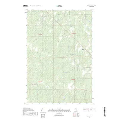
2023 Map of Whitney
USGS Topo · Published 2023About this map
Whitney anchors this Menominee County landscape, a small settlement situated amidst a dense network of waterways and converted rail trails. The Felch Grade Route Trl and Powers-arnold Route Trl cut across the township lines, marking former industrial corridors now serving as recreational paths. The terrain is defined by its complex hydrography, featuring multiple branches of Tenmile Creek and the headwaters of Whitney Creek. To the south, Indian Lake and Little Indian Lake provide clear focal points for the local geography. Numerous family-named roads, such as Janik Lane Number 48 and Wieciech Lane No 48.25, indicate the persistent pattern of rural landownership and localized development throughout the region.
Find a feature on this map
50 named features on this map. Tap any name to fly to it.
Don’t see what you’re looking for? This feature index may not catch every label — zoom into the map to look around manually.
Map Details
Editions of this 2023 Whitney Map
This is the sole edition of this map. No revisions or reprints were ever made.
Other maps of this area

1932 · Bark River NE
USGS Topo · 1:31,680

1932 · Whitney NE
USGS Topo · 1:31,680

1932 · Whitney SE
USGS Topo · 1:31,680

1954 · Escanaba
USGS Topo · 1:250,000

1956 · Foster City
USGS Topo · 1:62,500

1957 · Escanaba
USGS Topo · 1:250,000

1958 · Escanaba
USGS Topo · 1:250,000

1963 · Bark River
USGS Topo · 1:62,500

1963 · Powers
USGS Topo · 1:62,500

1963 · Schaffer
USGS Topo · 1:62,500