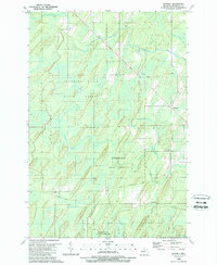
1989 Map of Whitney
USGS Topo · Published 1989About this map
The Hannahville Indian Community occupies a central portion of this landscape in Michigan's Upper Peninsula, set within the broader expanse of the Escanaba State Forest. The area is defined by a complex network of waterways, including Tenmile Creek, Whitney Creek, and Fortyseven Mile Creek, which weave through the lowlands between Spalding and Harris. The small settlement of Whitney appears in the northeast, positioned near a linear scar across the forest floor where an Old Railroad Grade marks a former route of industrial transit.
Find a feature on this map
13 named features on this map. Tap any name to fly to it.
Don’t see what you’re looking for? This feature index may not catch every label — zoom into the map to look around manually.
Map Details
Editions of this 1989 Whitney Map
This is the sole edition of this map. No revisions or reprints were ever made.
Other maps of this area

1932 · Bark River NE
USGS Topo · 1:31,680

1932 · Whitney NE
USGS Topo · 1:31,680

1932 · Whitney SE
USGS Topo · 1:31,680

1954 · Escanaba
USGS Topo · 1:250,000

1956 · Foster City
USGS Topo · 1:62,500

1957 · Escanaba
USGS Topo · 1:250,000

1958 · Escanaba
USGS Topo · 1:250,000

1963 · Bark River
USGS Topo · 1:62,500

1963 · Powers
USGS Topo · 1:62,500

1963 · Schaffer
USGS Topo · 1:62,500