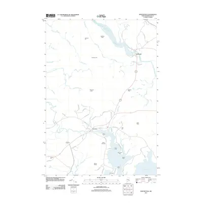
2011 Map of Whitneyville
USGS Topo · Published 2011About this map
The Machias River and Chandler River converge toward the coast in this detailed study of eastern Maine. The village of Whitneyville sits at a narrow point on the Machias, while Jonesboro occupies the crossing of the Chandler further south. The landscape is defined by a series of prominent rises and ridges, from the curiously named Mount Misery and Kilton Mountain to the sharp Porcupine Ledges. This era shows a community balanced between traditional river-oriented settlements and modern infrastructure like the Drisko Airport. Coastal features including Great Cove and Look Head mark the southern reach of the quadrangle, illustrating the complex shoreline of Washington County. Local travel is facilitated by a network of named ways such as Roque Bluffs Rd and Old Route 1, connecting inland hills to the sea.
Find a feature on this map
60 named features on this map. Tap any name to fly to it.
Don’t see what you’re looking for? This feature index may not catch every label — zoom into the map to look around manually.
Map Details
Editions of this 2011 Whitneyville Map
This is the sole edition of this map. No revisions or reprints were ever made.
Other maps of this area

1918 · Machias
USGS Topo · 1:62,500

1921 · Columbia Falls
USGS Topo · 1:62,500

1921 · Columbia Falls
USGS Topo · 1:62,500

1941 · Columbia Falls
USGS Topo · 1:62,500

1941 · Machias
USGS Topo · 1:62,500

1941 · Wesley
USGS Topo · 1:62,500

1941 · Gardner Lake
USGS Topo · 1:62,500

1942 · Columbia Falls
USGS Topo · 1:62,500

1943 · Wesley
USGS Topo · 1:62,500

1943 · Gardner Lake
USGS Topo · 1:62,500