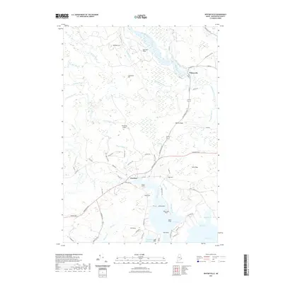
2021 Map of Whitneyville
USGS Topo · Published 2021About this map
Whitneyville and Jonesboro serve as the primary settlement hubs in this coastal Washington County landscape, where the Machias River and Middle River converge near the northern boundary. The terrain is defined by a dense network of coastal waterways and named ridges, illustrating the relationship between Maine's granite uplands and its tidal inlets. Local aviators use the Drisko Airport situated near the mouth of the Chandler River, while several named elevations like Kilton Mtn, Mt Misery, and Porcupine Ledges punctuate the wooded interior. Southward, the land fragments into points and coves along Mason Bay, including Look Head and Board Point. The road network, including Harrington Rd and Jonesport Rd, follows the historical contours of the land, connecting these remote townships to the surrounding coastal reaches.
Find a feature on this map
78 named features on this map. Tap any name to fly to it.
Don’t see what you’re looking for? This feature index may not catch every label — zoom into the map to look around manually.
Map Details
Editions of this 2021 Whitneyville Map
This is the sole edition of this map. No revisions or reprints were ever made.
Other maps of this area

1918 · Machias
USGS Topo · 1:62,500

1921 · Columbia Falls
USGS Topo · 1:62,500

1921 · Columbia Falls
USGS Topo · 1:62,500

1941 · Columbia Falls
USGS Topo · 1:62,500

1941 · Machias
USGS Topo · 1:62,500

1941 · Wesley
USGS Topo · 1:62,500

1941 · Gardner Lake
USGS Topo · 1:62,500

1942 · Columbia Falls
USGS Topo · 1:62,500

1943 · Wesley
USGS Topo · 1:62,500

1943 · Gardner Lake
USGS Topo · 1:62,500