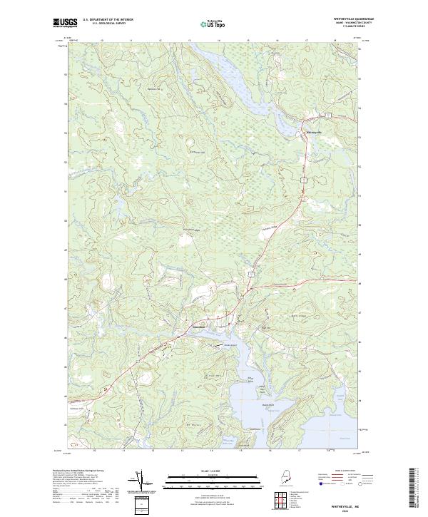
2024 Map of Whitneyville
USGS Topo · Published 2024About this map
The Machias River and Chandler River converge toward the Atlantic coast in this portrait of eastern Maine, where the settlement of Whitneyville sits at a narrow point in the river system. The landscape is defined by its coastal hydrology, from the tidal reaches of Tide Mill Creek and Mason Bay to the numerous interior brooks like Dan Hill Brook and Cothell Meadow Brook. The area shows a transition from the wooded ridges of Hawkins Ridge and Half Rock Ridge to the complex shoreline of Bobs Cove and Great Cove.
Find a feature on this map
75 named features on this map. Tap any name to fly to it.
Don’t see what you’re looking for? This feature index may not catch every label — zoom into the map to look around manually.
Map Details
Editions of this 2024 Whitneyville Map
This is the sole edition of this map. No revisions or reprints were ever made.
Other maps of this area

1918 · Machias
USGS Topo · 1:62,500

1921 · Columbia Falls
USGS Topo · 1:62,500

1921 · Columbia Falls
USGS Topo · 1:62,500

1941 · Columbia Falls
USGS Topo · 1:62,500

1941 · Machias
USGS Topo · 1:62,500

1941 · Wesley
USGS Topo · 1:62,500

1941 · Gardner Lake
USGS Topo · 1:62,500

1942 · Columbia Falls
USGS Topo · 1:62,500

1943 · Wesley
USGS Topo · 1:62,500

1943 · Gardner Lake
USGS Topo · 1:62,500