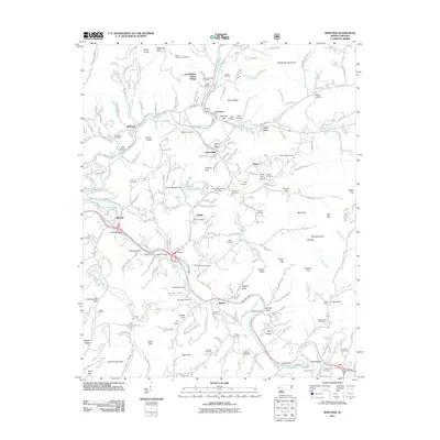
2011 Map of Whittier
USGS Topo · Published 2011About this map
Cherokee and the Oconaluftee Indian Village serve as cultural anchors in this mountainous region where the Oconaluftee River meets the Tuckasegee River. The map highlights a landscape of steep ridges and tucked-away coves, defined by landmarks like the Mountainside Theater and the Mount Noble Lookout Tower. Settlement patterns follow the river valleys and the many family-named cemeteries, such as the Birdtown, Stamper, and Sneed burial grounds, which offer significant value for genealogical research in these North Carolina communities.
Find a feature on this map
154 named features on this map. Tap any name to fly to it.
Don’t see what you’re looking for? This feature index may not catch every label — zoom into the map to look around manually.
Map Details
Editions of this 2011 Whittier Map
This is the sole edition of this map. No revisions or reprints were ever made.
Other maps of this area

1891 · Cowee
USGS Topo · 1:125,000

1893 · Mt Guyot
USGS Topo · 1:125,000

1897 · Cowee
USGS Topo · 1:125,000

1907 · Cowee
USGS Topo · 1:125,000

1912 · Mt Guyot
USGS Topo · 1:125,000

1933 · Bryson
USGS Topo · 1:62,500

1935 · Cullowhee
USGS Topo · 1:24,000

1935 · Addie
USGS Topo · 1:24,000
1936 · Greens Creek
USGS Topo · 1:24,000

1936 · Bunches Bald
USGS Topo · 1:24,000
Featured Places
- Cherokee, Yellowhill Community
- Birdtown Community, NC
- Indian Hills, NC
- Wilmot, NC
- Birdtown, Birdtown Community