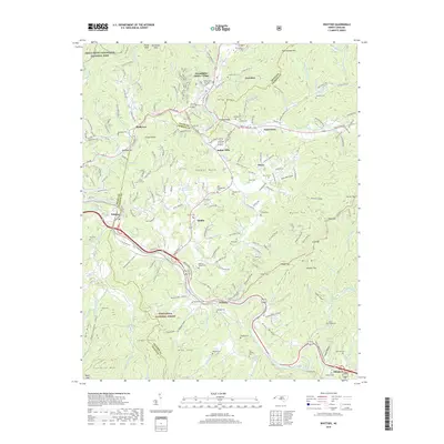
2019 Map of Whittier
USGS Topo · Published 2019About this map
The Oconaluftee Indian Village and the town of Cherokee serve as a cultural and geographic anchor where the Oconaluftee River meets Soco Creek. This landscape is defined by the meeting of Great Smoky Mountains National Park and the Nantahala National Forest, with the boundary between Swain and Jackson counties winding through the terrain. The settlement pattern follows the river valleys and deep coves, such as Thomas Valley and Hoot Owl Cove, where small communities like Whittier and Birdtown are situated. Numerous family and community burial sites, including Birdtown Cem, Stamper Cem, and the Nations Cem, are scattered across the ridges and gaps. To the south, the Tuckasegee River provides a transit corridor for roads and the railroad, which passes through the Cowee Tunnel near the town of Dillsboro.
Find a feature on this map
168 named features on this map. Tap any name to fly to it.
Don’t see what you’re looking for? This feature index may not catch every label — zoom into the map to look around manually.
Map Details
Editions of this 2019 Whittier Map
This is the sole edition of this map. No revisions or reprints were ever made.
Other maps of this area

1891 · Cowee
USGS Topo · 1:125,000

1893 · Mt Guyot
USGS Topo · 1:125,000

1897 · Cowee
USGS Topo · 1:125,000

1907 · Cowee
USGS Topo · 1:125,000

1912 · Mt Guyot
USGS Topo · 1:125,000

1933 · Bryson
USGS Topo · 1:62,500

1935 · Cullowhee
USGS Topo · 1:24,000

1935 · Addie
USGS Topo · 1:24,000
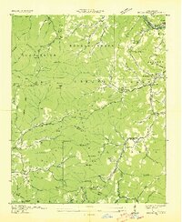
1936 · Greens Creek
USGS Topo · 1:24,000

1936 · Bunches Bald
USGS Topo · 1:24,000
Featured Places
- Cherokee, Yellowhill Community
- Birdtown Community, NC
- Indian Hills, NC
- Wilmot, NC
- Birdtown, Birdtown Community