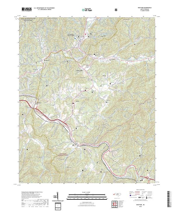
2022 Map of Whittier
USGS Topo · Published 2022About this map
The Oconaluftee Indian Village and the community of Cherokee serve as the cultural heart of this North Carolina landscape, where the Oconaluftee River joins the Tuckasegee River. This modern survey reveals a complex network of Bureau of Indian Affairs routes, including Bia HWY 420 and Bia HWY 414, which connect the tribal townships of Birdtown, Paint Town, and Qualla. The map provides significant genealogical value through its dense recording of family and community burial sites, from the Stamper Cem and Nations Cem in the east to the Owl Cem and Jones Cem further west.
Find a feature on this map
157 named features on this map. Tap any name to fly to it.
Don’t see what you’re looking for? This feature index may not catch every label — zoom into the map to look around manually.
Map Details
Editions of this 2022 Whittier Map
This is the sole edition of this map. No revisions or reprints were ever made.
Other maps of this area

1891 · Cowee
USGS Topo · 1:125,000

1893 · Mt Guyot
USGS Topo · 1:125,000

1897 · Cowee
USGS Topo · 1:125,000

1907 · Cowee
USGS Topo · 1:125,000

1912 · Mt Guyot
USGS Topo · 1:125,000

1933 · Bryson
USGS Topo · 1:62,500

1935 · Cullowhee
USGS Topo · 1:24,000

1935 · Addie
USGS Topo · 1:24,000
1936 · Greens Creek
USGS Topo · 1:24,000

1936 · Bunches Bald
USGS Topo · 1:24,000