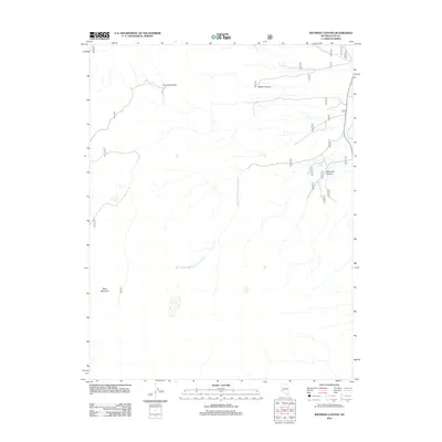
2012 Map of Wichman Canyon
USGS Topo · Published 2012About this map
Pine Grove Hills dominate the western horizon of this high-desert landscape in Lyon County, Nevada. The terrain is defined by its deep drainages, including the eponymous Wichman Canyon and nearby Halsey Canyon. Water sources are sparse but critical to this arid region, marked by the presence of Paradise Spring and the winding course of South Fork Cottonwood Creek. To the southwest, the rise of Bald Mountain punctuates the topography. The map illustrates a network of specialized routes, such as 142 and 762, which navigate the complex elevations of the basin-and-range country. This area represents a classic Nevada interior where geography dictated historical travel patterns between spring locations and canyon passages.
Find a feature on this map
22 named features on this map. Tap any name to fly to it.
Don’t see what you’re looking for? This feature index may not catch every label — zoom into the map to look around manually.
Map Details
Editions of this 2012 Wichman Canyon Map
This is the sole edition of this map. No revisions or reprints were ever made.
Other maps of this area

1891 · Wellington
USGS Topo · 1:125,000

1893 · Wellington
USGS Topo · 1:125,000

1909 · Hawthorne
USGS Topo · 1:250,000

1909 · Bridgeport
USGS Topo · 1:125,000

1911 · Bridgeport
USGS Topo · 1:125,000

1911 · Hawthorne
USGS Topo · 1:250,000

1915 · Hawthorne
USGS Topo · 1:250,000

1920 · Bridgeport
USGS Topo · 1:125,000

1948 · Walker Lake
USGS Topo · 1:250,000

1956 · Mt. Grant
USGS Topo · 1:62,500