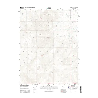
2014 Map of Wichman Canyon
USGS Topo · Published 2014About this map
The Toiyabe National Forest dominates the high desert terrain of Lyon County in this 2014 survey, where the Pine Grove Hills meet the watershed of the East Walker River. This topography is defined by sharp elevation changes, peaking at Bald Mtn and dropping into the steep-walled Wichman Canyon. The landscape shows the importance of water management in this arid region, with Parade Spring and drainage systems like Cottonwood Creek and the S Fork Cottonwood Cr providing the few perennial water sources. The map preserves the historical cadastral divisions across townships such as t9n r26e, tracing the access routes that navigate through the deep cuts of Nye Canyon and Halsey Canyon.
Find a feature on this map
17 named features on this map. Tap any name to fly to it.
Don’t see what you’re looking for? This feature index may not catch every label — zoom into the map to look around manually.
Map Details
Editions of this 2014 Wichman Canyon Map
This is the sole edition of this map. No revisions or reprints were ever made.
Other maps of this area

1891 · Wellington
USGS Topo · 1:125,000

1893 · Wellington
USGS Topo · 1:125,000

1909 · Hawthorne
USGS Topo · 1:250,000

1909 · Bridgeport
USGS Topo · 1:125,000

1911 · Bridgeport
USGS Topo · 1:125,000

1911 · Hawthorne
USGS Topo · 1:250,000

1915 · Hawthorne
USGS Topo · 1:250,000

1920 · Bridgeport
USGS Topo · 1:125,000

1948 · Walker Lake
USGS Topo · 1:250,000

1956 · Mt. Grant
USGS Topo · 1:62,500