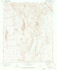
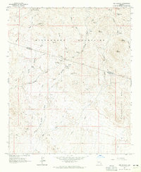
1965 Map of Wickenburg SW
USGS Topo · Published 1973About this map
The Vulture Mountains dominate this desert landscape northwest of Phoenix, characterized by a network of drainage washes and historical mining activity. The Hassayampa River cuts through the eastern portion of the sheet, where seasonal water flow once supported early industrial sites like the Smith Mill (Site). Transportation in the mid-1960s was defined by the Atchison Topeka And Santa Fe railroad and numerous desert tracks, including several designated Jeep Trail routes and a remote Landing Strip. Evidence of early settlement and resource extraction is scattered throughout the terrain, from a solitary Grave near the river to various Mine workings and a Gravel Pit. The southern reaches of the map show the corner of LUKE AUXILIARY FIELD NO 4 (City of Phoenix), illustrating the post-war military and municipal expansion into the Maricopa County desert.
Find a feature on this map
17 named features on this map. Tap any name to fly to it.
Don’t see what you’re looking for? This feature index may not catch every label — zoom into the map to look around manually.
Map Details
Editions of this 1965 Wickenburg SW Map
3 editions found
Other maps of this area

1954 · Phoenix
USGS Topo · 1:250,000

1957 · Phoenix
USGS Topo · 1:250,000

1957 · White Tank Mts. NE
USGS Topo · 1:24,000

1957 · White Tank Mts.
USGS Topo · 1:62,500

1958 · Phoenix
USGS Topo · 1:250,000

1960 · Phoenix
USGS Topo · 1:250,000

1961 · Vulture Mountains
USGS Topo · 1:62,500

1962 · Belmont Mts
USGS Topo · 1:62,500
1964 · Wickenburg
USGS Topo · 1:24,000
1964 · Red Picacho
USGS Topo · 1:24,000