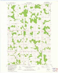
1982 Map of Wien
USGS Topo · Published 1982About this map
Wien and the surrounding townships of Marathon County are defined by a high-density grid of family dairy farms and rural crossroads as they appeared in the early 1980s. The landscape is a rhythmic alternation of cultivated fields and woodlots, drained by a network of small waterways including Scotch Creek, Bear Creek, and Draeger Creek. Small, localized community centers like Wuertsburg and Schnappsville anchor the agricultural territory, reflecting the traditional settlement patterns of the Upper Midwest.
Find a feature on this map
17 named features on this map. Tap any name to fly to it.
Don’t see what you’re looking for? This feature index may not catch every label — zoom into the map to look around manually.
Map Details
Editions of this 1982 Wien Map
This is the sole edition of this map. No revisions or reprints were ever made.
Other maps of this area

1902 · Marathon
USGS Topo · 1:125,000

1951 · Athens
USGS Topo · 1:48,000

1951 · Hamburg
USGS Topo · 1:48,000

1953 · Marathon
USGS Topo · 1:48,000

1953 · Stratford
USGS Topo · 1:48,000

1953 · Eau Claire
USGS Topo · 1:250,000

1953 · Rice Lake
USGS Topo · 1:250,000

1954 · Iron Mountain
USGS Topo · 1:250,000

1955 · Green Bay
USGS Topo · 1:250,000

1958 · Eau Claire
USGS Topo · 1:250,000