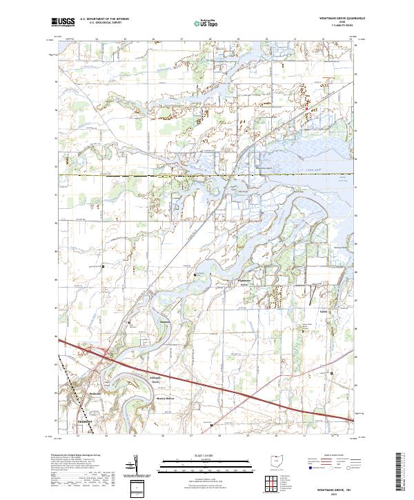
2023 Map of Wightmans Grove
USGS Topo · Published 2023About this map
The Sandusky River winds toward its outlet at Muddy Creek Bay on Lake Erie, defining the geography of this Sandusky County landscape. Near the river mouth, Wightmans Grove serves as a focal point among the marshy inlets and points like Poplar Point and Elm Point. The transition from the open waters of the bay to the agricultural interior is marked by an extensive network of drainage ditches such as Mehlow Ditch and Druckenmiller Ditch, essential for managing the low-lying terrain of the Cottonwood Swale.
Find a feature on this map
60 named features on this map. Tap any name to fly to it.
Don’t see what you’re looking for? This feature index may not catch every label — zoom into the map to look around manually.
Map Details
Editions of this 2023 Wightmans Grove Map
This is the sole edition of this map. No revisions or reprints were ever made.
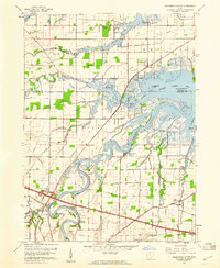
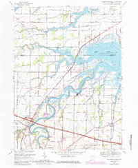
Historical Maps of Muncie Hollow Through Time
3 maps found