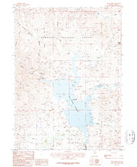
1986 Map of Wild Horse
USGS Topo · Published 1987About this map
Wild Horse Reservoir dominates this high-altitude landscape in northern Elko County, serving as the central feature for local recreation and water management. The 1980s terrain is defined by the Owyhee River and its numerous tributaries, including Beaver Creek and Hendricks Creek, which feed into the primary basin. The settlement of Wild Horse sits at the southern edge of the reservoir, supported by a Landing Strip and seasonal facilities like a Trailer Park and Boat Ramp.
Find a feature on this map
28 named features on this map. Tap any name to fly to it.
Don’t see what you’re looking for? This feature index may not catch every label — zoom into the map to look around manually.
Map Details
Editions of this 1986 Wild Horse Map
This is the sole edition of this map. No revisions or reprints were ever made.
Other maps of this area

1935 · Charleston
USGS Topo · 1:48,000

1936 · Mountain City
USGS Topo · 1:62,500

1936 · Rowland
USGS Topo · 1:48,000

1940 · Rowland
USGS Topo · 1:62,500

1940 · Mountain City
USGS Topo · 1:62,500

1942 · Mt. Velma
USGS Topo · 1:62,500

1955 · Wells
USGS Topo · 1:250,000

1956 · Wild Horse
USGS Topo · 1:62,500

1958 · Wells
USGS Topo · 1:250,000

1961 · Wells
USGS Topo · 1:250,000