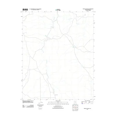
2011 Map of Wildcat Ranch
USGS Topo · Published 2011About this map
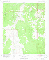
Wildcat Ranch serves as the primary landmark in this arid stretch of Mohave County, where the landscape is defined by the winding network of the Parashant Wash. This 2011 survey illustrates the sparse water management and land usage patterns essential for survival in this high-desert environment. Strategic infrastructure such as Esplin Tank, Red Pond, and Pigeon Tank are mapped as vital resources for both ranching operations and local wildlife. To the northeast, the presence of Salt Spring indicates a natural mineral-rich water source, while the surrounding terrain is marked by a intricate web of local roads and unimproved trails that connect these isolated outposts. The map provides a clear look at the region's topography before more modern development, emphasizing the vast distances between reliable water and the humble footprint of the ranching industry.
Find a feature on this map
6 named features on this map. Tap any name to fly to it.
Don’t see what you’re looking for? This feature index may not catch every label — zoom into the map to look around manually.
Map Details
Editions of this 2011 Wildcat Ranch Map
This is the sole edition of this map. No revisions or reprints were ever made.
Other maps of this area

1886 · Mt. Trumbull
USGS Topo · 1:250,000

1892 · Mt. Trumbull
USGS Topo · 1:250,000

1953 · Grand Canyon
USGS Topo · 1:250,000

1957 · Grand Canyon
USGS Topo · 1:250,000

1958 · Grand Canyon
USGS Topo · 1:250,000

1960 · Grand Canyon
USGS Topo · 1:250,000
1967 · Yellow John Mtn.
USGS Topo · 1:24,000
1971 · Castle Peak
USGS Topo · 1:24,000
1971 · Poverty Spring
USGS Topo · 1:24,000
1971 · Wildcat Ranch
USGS Topo · 1:24,000