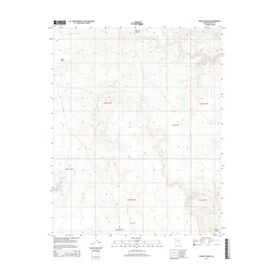
2014 Map of Wildcat Ranch
USGS Topo · Published 2014About this map
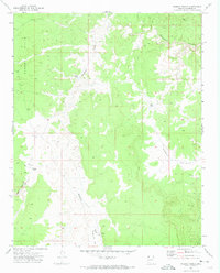
Wildcat Ranch and the deep drainage of Parashant Canyon define this high-desert landscape in Mohave County. The map details a complex system of seasonal water management and natural springs, essential for ranching and survival in this arid environment. Significant features include Salt Spring in the northeast and a series of livestock water sources like Esplin Tank, Red Pond, and Pigeon Tank. The terrain transitions from the elevated Hidden Hills and Agway Valley down into the broad expanse of McDonald Flat. Parashant Wash serves as the primary hydrological artery, winding through the center of the sheet towards the southeast. A single named road, CR 103, provides the only major access through the western portion of the area, connecting the remote canyon systems of Pigeon Canyon and Andrus Canyon to the broader region.
Find a feature on this map
17 named features on this map. Tap any name to fly to it.
Don’t see what you’re looking for? This feature index may not catch every label — zoom into the map to look around manually.
Map Details
Editions of this 2014 Wildcat Ranch Map
This is the sole edition of this map. No revisions or reprints were ever made.
Other maps of this area

1886 · Mt. Trumbull
USGS Topo · 1:250,000

1892 · Mt. Trumbull
USGS Topo · 1:250,000

1953 · Grand Canyon
USGS Topo · 1:250,000

1957 · Grand Canyon
USGS Topo · 1:250,000

1958 · Grand Canyon
USGS Topo · 1:250,000

1960 · Grand Canyon
USGS Topo · 1:250,000
1967 · Yellow John Mtn.
USGS Topo · 1:24,000
1971 · Castle Peak
USGS Topo · 1:24,000
1971 · Poverty Spring
USGS Topo · 1:24,000
1971 · Wildcat Ranch
USGS Topo · 1:24,000