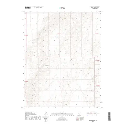
2018 Map of Wildcat Wash NE
USGS Topo · Published 2018About this map
The Meadow Valley Mountains dominate the central landscape of this Lincoln County survey, providing a detailed look at the drainage patterns of the high desert. The ephemeral channels of Wildcat Wash and Farrier Wash define the local topography as they move through the arid terrain, illustrating the natural water management of the basin. Along the eastern edge of the quadrangle, the Bunker Hills rise as a significant landform, while the western portion transitions into the open expanse of Coyote Spring Valley. This map documents the precise Township and Range grid system across a region of Southeastern Nevada where the landscape remains largely defined by its geologic features and hydrologic corridors rather than human development.
Find a feature on this map
12 named features on this map. Tap any name to fly to it.
Don’t see what you’re looking for? This feature index may not catch every label — zoom into the map to look around manually.
Map Details
Editions of this 2018 Wildcat Wash NE Map
This is the sole edition of this map. No revisions or reprints were ever made.
Other maps of this area

1885 · Pioche
USGS Topo · 1:250,000

1886 · Saint Thomas
USGS Topo · 1:250,000

1886 · Pioche
USGS Topo · 1:250,000

1893 · Saint Thomas
USGS Topo · 1:250,000

1954 · Caliente
USGS Topo · 1:250,000

1954 · Las Vegas
USGS Topo · 1:250,000

1957 · Las Vegas
USGS Topo · 1:250,000

1959 · Caliente
USGS Topo · 1:250,000

1959 · Las Vegas
USGS Topo · 1:250,000

1962 · Las Vegas
USGS Topo · 1:250,000